Geophysical survey blog: first two days
- clareleigh2012
- Mar 10, 2024
- 3 min read
Updated: Mar 11, 2024
IAG geophysical survey on Sleights Pasture prehistoric monument complex 3 & 4 March 2024.
By Carol Perry, Tony Perry, Yvonne Luke.

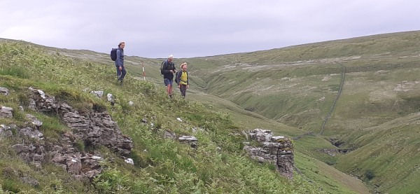
Ribblehead was true to form initially and we had to cancel Saturday because of atrocious weather but the weather gods smiled on us cairners (geophysics division) on Sunday 3 March! Yvonne, Dr Rick Peterson (Reader in Archaeology at UCLAN), Rowan, Beverley, Vicki, Carol, Tony plus Claire Hodgson (Yorkshire Dales Project Officer from Our Common Cause: Our Upland Common project) and her father Ray met at 10:30am on a bright morning in the usual lay-by near Sleights Pasture. Rick provided the equipment - a magnetometer and a soil resistance meter - as well as his expertise. Ingleborough looked magnificent covered in snow and shining in the sun.

Under Rick’s supervision we first laid out a 30m grid using red pegs, aligned north south (for the magnetometry), to millimetre precision using Rick’s highly accurate Total Station. We had to use non-magnetic tapes and plastic pegs to eliminate any metal interference with the magnetometry.
Then we laid out guide tapes for soil resistance measurement with plastic beads 1 metre apart to guide sampling at half metre resolution (which was the resolution chosen for the resistance survey). Resistance is compared between the two probes of the machine and two fixed points 50m away.
With 3600 points needing to be sampled for each 30m grid, there was plenty of opportunity for everyone to have a go! The whole exercise is based on a grid system which, for technical reasons associated with the use of magnetometry, has to be lined up with N-S compass points. These had been plotted by Rick initially on a computer and transferred to the field via GPS and the Total Station. Rick showed us how to operate the resistance meter before completing the marking out of the site. He then, aided by around half of the IAG team, proceeded to perform the magnetometry. This requires skill and experience to get it right as well as an absence of any metal about the person. Zips and hiking boot metal tags are definitely not allowed.

The magnetometry covered a much wider area than the soil resistance survey – 24 grids as opposed to 4. As no part of the machine needs to touch the ground the whole exercise is much faster than using the resistivity meter. Rick followed parallel metre lines across the grid back and forth, aided by marker canes moved along by the survey team. He did 8 grids the first day and a magnificent 16 on the second day, when he positively flew! The whole site is full of trip hazards, from tussocky limestone pavement to the stone scatters and rocks associated with the archaeology. Rick appeared to complete the task without once tripping up, which was no mean feat.
Meanwhile the resistance survey progressed more slowly but steadily. Rocky patches within the monument complex presented our first challenge - using the dummy log system appeared to be more straightforward than it actually was in practice, as was the delete system! However, although part of the grid had to be resurveyed, it was completed in the end!

The second day (Grid 2) involved climbing what felt like the mountainous bank of the cairn (2m high!) and down the other side with the meter – not something that can be tackled at speed! At the slow halting pace required it started to feel a bit like using a zimmer frame! We ground to a halt when the battery ran out – another lesson learnt. Rick has left us with the resistivity equipment to finish the 4 grids, so we will see how we get on without him next weekend ………!
A truly superb first couple of days and a lot of learning for us about geophysical surveys.
We discovered that mistakes can be quite helpful, if severe, teachers!
Wildlife of the day: the sound of curlews. Sight of the day: Ingleborough